Category Archives: Places

Settlement of the Berkshires – Poontoosuck

Settlement of the Berkshires – Poontoosuck

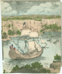
Of the five Berkshire towns whose settlement have are briefly covered in these blogs(Sheffield, Stockbridge, Great Barrington, Poontoosuck* and Lenox), Poontoosuck (Pittsfield) suffered the most from the continuing conflict between New England settlers and the French and their Indian allies.

In 1722, 177 men from Hampshire County sought a grant for the “Valley of the Hoosatonuk,” or “Westbrook.”  By 1735 Boston was seeking proprietors for 3-4 townships to

-generate income for the Boston poor and free schools

-establish settlement in the area recently disputed with New York

-populate the area with Massachusetts men (and women) who could protect the colony from future invasions from New France (Canada.)

Col. Jacob Wendall purchased the 24,000 acres that would become Pittsfield for about 2100 pounds.  He partnered with Phillip Livingston of New York and Capt. John Stoddard of Northampton who had already been given 1000 acres in return for his military service. Livingston had thought to sell parcels to 60 Dutch families there from New York to meet the settlement requirements.  The New Yorkers were not that interested plus someone got around to read the fine print of the grant and realized the settlers had to be from Massachusetts.

Finally, in 1743, 40 young men had been assembled who were ready, willing and able to take their chances in return for cheap land in this frontier area and clearing began.  Unfortuntely, war broke out again in 1744 (King George’s War/ War of the Austrian Succession) and clearing and building was largely abandoned.  Many of these men would have been back and forth for general militia duty or defense of Fort Massachusetts (near modern day Adams).

Massive Forests to Clear

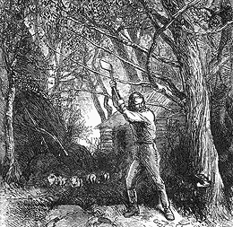
With peace, many of these hopefuls returned along with additional  purchasers, and by 1752 some temporary log cabins were built.  The first settlers, Solomon Deming and his wife Sarah travelled through the woods clearing a path as they went.  They came from Wethersfield and others from Connecticut and Northampton followed.  By 1753 things were looking promising enough that a petition was presented to the general court for township status (which would have provided for collection of taxes for roads, meeting house, etc.)  Good progress had been made with most of the 60 proprietor lots taken up and population had climbed to around 200. However progress was again halted by war.

The Flight from Poontoosuck and Lenox to Stockbridge

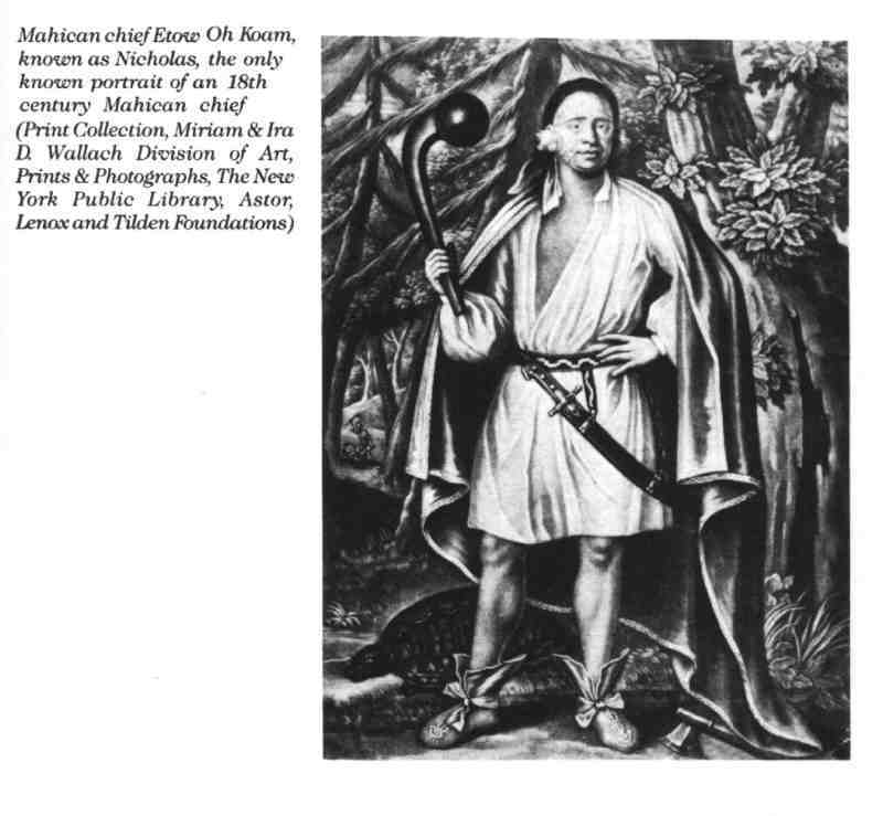
Although the concentrated Indian population of the Berkshires (about 300 Stockbridge Indians) remained peaceful, several Indians wondering through the Berkshires and angered by the death of a family member in a horse theft incident touched off a new wave of fear of Indian attack.  This was followed in short order by a new French and Indian War in 1756.

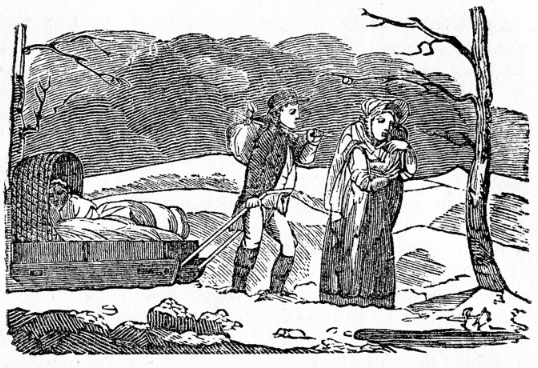
Based on the initial Indian violence in 1753, Berkshire County sent for reinforcements.  With the help of horses from Connecticut, Poontoosuck evacuated to Stockbridge in haste.  The refugees were fired on as they fled south and one man (Stevens or Stearn) was killed.  The woman riding with him was rescued by Jonathan Hinsdale of Lenox.

Developing Property vs. Serving in the Militia

Would Have Come to Pontoosuck on Narrow Trails Through the Woods

Settlers tried to return to protect, and if possible, cultivate their properties.  Many of the men would have been in the militia defending Fort Massachusetts (near Adams), Fort Anson in Poontusuck, or to participate in the ill-fated attempt to capture Fort Ticonderoga.  Poontoosuck would have been a stopping place for troops from the rest of New England on their way to Canada or Fort Royal and some would return as settlers.

Settlement Began in Earnest in 1759

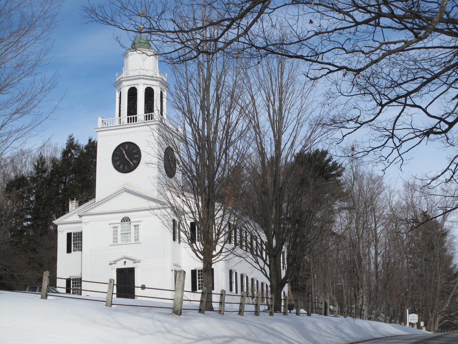
With Wolfe’s capture of Quebec in 1759 settlers started returning in earnest.  In 1761 Poontusuck was granted the right to incorporate and the name Pittsfield was chosen in honor of Prime Minister William Pitt who had lobbied Parliament to provide military support for the colonists against the French and the Spanish.

*”Poontoosuck” = another phonetic Indian name spelled many different ways.  This spelling is taken from the 1752 survey.

See

A History of the County of Berkshire, Massachusetts, by David Dudley Field and Chester Derwey, Pittsfield 1929, “A History of the Town of Pittsfield, ” by Henry Strong

A History of  the Town of Pittsfield in Berkshire County, Massachusetts 1734-1800, by J.E.A Smith, Published by The Town of Pittsfield, 1868

Berkshire Creative Website, 2014

Wikipedia, 2014

Settlement of Great Barrington

Modern Main Street Great Barrington

Settlement Expands to Upper Housatonic Township – Great Barrington

Voted the “Best Small Town in America,”* by Smithsonian Magazine in 2012, Great Barrington has clearly overcome early bumps in the road. However, in its early formation and settlement, Great Barrington illustrated the challenges in the systematic process  of town formation the Puritans and then the Massachusetts Royal Government had practiced for more than 100 years. Like all systems, the town formation approach required good and consistent leadership, and some luck.  It is also possible that by the mid 18th century the old ways were loosening up.

The Great Wigwam and the Patent of Wesbenhook

Unlike Lenox (for which we find no record of activity before the first settler in 1751), Great Barrington was active well before European settlement.

There is record of a “Great Wigwam” Indian settlement (thought to be near the current site of the Congregational Church)at a ford over the Housatonic but most of the Indians were gone by 1694 – said to have fled west in 1676 as a result of King Phillip’s War.

As with Sheffield and much of the rest of Berkshire County, the area had been part of a parcel (called the Patent of Westenhook which included modern day Sheffield, Great Barrington, Stockbridge, West Stockbridge, Mount Washington, Egremont and Alfrod) claimed by major landholders in New York (1685) and was open to Dutch settlers in 1705*.*  However, there was very little settlement.

It was was also on the trail (road would be an overstatement) that went from Springfield to Westfield to Kinderhook to Albany and was used by soldiers from King Phillip’s War (1676) on.

In 1722 the General Court granted the opportunity to settle lower and Upper Housatonic townships. and in 1724 property was purchased from the Mahicans.  The request made in 1733 to incorporate much of the lower parcel as Sheffield in 1733 was accepted in 1741.

Town Status and Settlement Delayed by New York Claims, Stockbridge Mission

The conflicting property claims (New York – Wesbenhook Patent vs. Massachusetts purchase from Chief Konkapot) came to a head about 1726-27.  At least one Massachusetts settler was arrested for trespassing and transported to Albany and further land sale and settlement was stalled.

Then, in 1733, the General Court passed an order appointing John Ashley, Ebeneezer Pomeroy, Esq.’s, and Mr. Thomas Ingersoll to”bring forward” settlement of the Upper Township within two years. As late as 1742, Ephraim Williams was still bringing complaints about New Yorkers surveying properties in the Upper Housatonic.

In 1736 the portion of the upper township above Monument Mountain was set aside for the Stockbridge Indian Mission and further property distribution was again halted.

One author described the Upper Township remaining as “wild as ever, a plague to the decent people in the northern part of Sheffield.”** Perhaps some of this “wildness” could be attributed to stop/start nature of the town’s status – the challenges from the Dutch claims in 1727, partition to Stockbridge in 1736, complaints about how land was being distributed and dismissal of David Ingersoll as clerk in 1749 (and annulment of all prior land distributions) – or perhaps just loosening of standards from an earlier time.

By 1742 this “plague to decent people” had 200 residents and won the right to be the North Parish of Sheffield and obtain their own minister.  They succeeded in attracting young Rev. Samuel Hopkins in 1743. However, due to delays in organizing the parish, he was not installed until 1745.

Town Status Finally Achieved in 1761- the County Seat Until After the Revolutionary War.

A further impediment to settlement, which the future Great Barrington shared with the rest of the future Berkshire County, was the French and Indian Wars  Citizens were enlisted for the 1746-1747 march on Canada under Capt. Williams.  Alarms and militia enlistment continued from 1753 to 1760.  General Amherst marched through the town in 1758 on his way to attack Ticonderoga.

Finally, in 1761 the General Court allowed the North Parish to become the town of Great Barrington. Great Barrington was the site of the County Courts in 1774 and was a scene of early defiance of the Royal government.  The town would go on to play an important role in the Revolution as well as in the aftermath – Shay’s Rebellion.

—————————-

*”The 20 Best Small Towns in America of 2012,” by Susan Spano and Aviva Shen,  Smithsonian Magazine, May 1, 2012

**History of Great Barrington, Charles James Taylor, Clark W. Bryan Publ., 1882

***Housatonic, Puritan River, by Chard Powers Smith, Rinehart and Company, 1946, p. 59

Also see:  A History of the County of Berkshire, Massachusetts, David Dudley Field, Printed by Samuel Bush, Pittsfield, 1829 “Great Barrington.”,  History of Great Barrington, 

Lenox Crossroads and Bypasses

The Curtis Hotel - mid 19th Century
The Curtis Hotel – mid 19th Century

Started as a Stagecoach Stop

Since the earliest days of the county  Lenox’s Main St. has been a path-road-highway from the southern entrance to the county to Pittsfield.  The site of the Curtis Hotel was a stagecoach stop before Lenox even existed as a town.


Lenox Main Street Settled Into Current Location About 1800

Entering Lenox from Kemble Street in Horse and Buggy Days

Until about 1800 Lenox Main St. wandered to the East and to the West, finally settling on approximately its current course.  The entrance to town was Old Stockbridge Road with Walker St. and Kemble St. added later.

Main Street Before Route 7 and Before Bypass
Main Street Before Route 7 and Before Bypas

We have some photos of the way Main St. would have looked with first buggies – then flivers tootling down the street.

Prior to 1922 the Berkshire County north- south route was marked by blue bands on telephone poles.  Beginning in the 1920’s, hotel operators and automobile clubs initiated the development of a numbering system in which this route was known as Highway 4.  The Federal Government had taken over route numbering and in 1926 Highway 4 was renamed U.S. Route 7.

Until the 1949 Bypass, Hills Remained a Problem

Looking North on Main Street Toward Church on the Hill

The same topography that makes Lenox so scenic created a challenge for travelers in the form of the hill up Old Stockbridge Road (known from the 19th century shire town days as Court House Hill) and the Hill up to the Congregational Church — both of which were burdens for wagons and later  trucks. This may have been one of the main reasons historic Lenox village was able to retain its old Main Street when the bypass was (per MassDOT) began in 1949.

Mid Twentieth Century Fun for Residents and Visitors Along the New Bypass

Miniature Golf on Route 7

There is a great Facebook Page – You Know You’re From Lenox If.. where contributors have shared some photos from the 1960’s and 1970’s Route 7 including the Miniature Golf Course (site of the current Burger King) and favorite restaurants including the Yellow Aster (site of current Mazzeo’s)

The Yellow Aster - A Popular Route 7 Restaurant of the 1970's
The Yellow Aster – A Popular Route 7 Restaurant of the 1970’s,


How Much Expansion?

The initial bypass was controversial – some new businesses were created while others were – well – bypassed.  However, the flood of tourists to Tanglewood and other summer events continued and more highway expansion was planned – and protested – and planned again.  The four lane traffic flow on Route 7 from Lenox to the Pittsfield line was completed in 2000.  A further expansion of four lane road was contemplated to Lanesborough.  We’ll see.

See Old Route 7, Along the Berkshire Highway by Gary T. Leveille


Stockbridge Indian Mission

The Stockbridge Indian lands included part of what would become Lenox.  Why the Stockbridge Indians were here and why they sold their land is an important part of the story of the settlement of the Berkshires. The story is complex and poignant.  Blog readers are particularly encouraged, on this topic, to follow up with the many fine books and other sources listed below.

Very briefly

  • The Mahicans*, in 1734, found themselves in a difficult situation.  Part of the Algonquin linguistic group of Native Americans that extended southward from Canada, the Mahicans had formerly occupied both sides of the Hudson River and their ancestors probably had been among those who watched with amazement in 1609 as Henry Hudson sailed by.   They had survived on a combination of limited agriculture and woodland hunting (see Life Berkshire Before Europeans.) By now they had been decimated by disease and changes wrought by the Europeans to their homeland. They were hemmed in by their Mohawk enemies to the west and explosive European expansion to the east. (Various spellings of the tribe’s name have been found — Mohican,   Mahican, etc.)
Mahican Etow Oh Koam, known as Nicholas (18th century depiction from New York Public Library Collections)
Mahican Chief Etow Oh Koam, known as Nicholas (18th century depiction from New York Public Library Collections)
  • Although sentiment about Indians, even the Mahicans who had been allies of the English for several generations, was mixed, there was a group of religious leaders who felt obliged to honor what had been part of the original Puritan mission (to bring Christianity to the Native Americans).  In addition, it was in the political interest of the English Colonial government to cement Indian allies in their continuing wars with the French and their Indian allies
  • Much of modern day Sheffield and Great Barrington had already been sold, by the Mahicans, for colonial  settlement
  • Consequently, the royal government of Massachusetts and a missionary group agreed to purchase a tract of  (est.) 9000 acres north of modern day Great Barrington to establish a mission for the Mahicans and other Native American allies. The agreement was that the Mission would include establishment of minister to teach the gospel to the Indians, a school, and settlement of four English families to lead the Mohicans in learning the ways of Christianity and English life.
  • The minister (John Sergeant) who agreed to launch this effort did establish a mission in 1738 and made every effort  to live up to the high ideals set for the mission.
Mission House Stockbridge
  • However, despite the high ideals, this agreement with Native Americans, like so many before and after, would be overwhelmed by the Europeans’ lust for land and their sense of entitlement.
  • The Mohicans farmed (although the men still thought of it as women’s work), converted to Christianity, went to school, and fought (and died) side by side with their English (and later American) allies.  However, the also found themselves with less land or less desirable land than had originally been envisioned (because, among other things more than the four families settled).
  • With no source, other than the sale of their land, for exchange for rum (illegal but sold anyway) and trade goods, they sold to the colonials.  The land for goods/land for currency exchanges that resulted may have allowed the colonials to feel justified in what they were doing but were, in hindsight, one sided and unfair.
  • An example of this one sided trading is highly relevant to the history of Lenox.  In 1739, the Indians wanted some 280 acres of meadowland recently sold for 450 pounds.  To obtain the meadowlands, the Indians gave up 4,000 acres  to the northeast – most of present-day Lenox.  The new owners of this extensive woodland included the proprietors of the mission and were: Stephen Williams, Samuel Hopkins, Neimiah Bull, John Sergeant, , Timothy Woodbridge, Ephraim Williams, and John Stoddard’s nephew Jonathan Edwards.  Ephraim Williams acquired 900 acres plus a 130 acre pond, Bull 700 acres, and the remainder approximately 480 acres each.  (Some pretty sharp Yankee dealing for a bunch of missionaries.)
  • Eventually, the Stockbridge Indians found themselves with more and more mouths to feed on less and less land.  In 1780, many accepted the invitation of their Oneida cousins to resettle in upstate New York and stayed their long enough for their tales to influence James Fenimore Cooper to write The Last of the Mohicans.  The modern day Stockbridge Indians are to be found in Wisconsin where they remain one of only a few tribes that have retained their pre-colonial identity.

See:

To Live Upon Hope, Mohicans and Missionaries in the Eighteenth Century Northeast by Rachel Wheeler

The Mohican World, 1680-1750 by Shirley W. Dunn

Lenox Massachusetts, Shiretown by David Wood


Settlement of Berkshire County Begins With Sheffield

Settlement of Berkshire County Begins with Sheffield

As early as 1662, John Pynchon, son of the founder of Springfield, attempted to establish a trading post on the Housatonic between what would become Sheffield and Ashley Falls.  The area was too wild to sustain the post but it does indicate the area was known to the English settlers of the Connecticut River Valley.

What an Early Woodland Path Might Have Looked Like

In 1725, with authorization from the Massachusetts General Assembly a committee bought from Sachem Konkapot the southwestern corner of what would become Berkshire County.  The tract was about 12 miles wide and 18 miles long and included much of modern-day Sheffield, Great Barrington Egremont and Mount Washington as well as parts of what would become Alford, Stockbridge, West Stockbridge and Lee.

Purchased from Chief Konkapot

Originally called Outhotonnook (later corrupted as Housatonic), meaning “over the mountain”, the land was purchased by a committee approved by the General Court on April 25, 1724, from Chief Konkapot and 20 other Mahican Indians. Its price was 460 pounds, 3 barrels of cider and 30 quarts of rum. The committee was to manage apportionment of land and supervise settlement (see New England Town Formation).

First Settler Mathew Noble from Westfield

The lower township of Housatonic (as Outhotonnook would be corrupted) was first settled by Matthew Noble of Westfield, who arrived in 1725. Many of the earliest English settlers came from Westfield.  These would, like many other early settlers of the Berkshires, have been ambitious, hearty frontier people whose parents or grandparents would have been initial settlers of the Connecticut River Valley or lower Housatonic Valley.  The New World economy was still driven by land and rapid population growth meant buying low and selling  high was the entrepreneurship of the day.  It would have been hard work.  Mathew Noble spent the first winter, entirely alone except for a few Mahicans, clearing and putting up rudimentary shelter.  His 16 year old daughter (one of nine Noble children) would follow in June wending her way through the dense woods riding on horseback with her mattress.

Importance for Lenox History

Sheffield was not only the first settlement but one to which Lenox had many direct ties.  Theodore Sedgwick first practiced here and defended the famous Mumbet who was owned by Sheffield resident Colonel Ashley.  The final “battle” of Shay’s rebellion was fought here.

The family names of the initial Sheffield settlers would find their way into Lenox and the rest of the Berkshires….including Ingersoll, Dewey, Judd, and Egleston.

Beginnings of Berkshire County Late in Colonial Period

What would become Berkshire County (1761) was settled relatively late in the colonial period because:

the 85 years of wars with New France and their Indians allies discouraged settlement in wilderness areas

-there were border disputes between the Dutch and the English; and later,  the royal provinces of New York and Massachusetts

Sheffield Landscape DSCN9314
Sheffield, at least according to its historians, had some of the most farmable land in the county

-better farmland was, at least until the 18th century, elsewhere (Connecticut and Hudson River Valleys)

-hills, thick woods and, other than a few Indians trails(one roughly along modern route 23) and the Housatonic River, the area was impenetrable.

At the time of the earliest European settlement in the Berkshires, the hilly and heavily wooded area was sparsely populated by Native Americans – primarily Mahicans.

The earliest known European inhabitants of the Berkshires probably would have been Dutch. In the 1680’s Dutchmen from New York started buying up parcels from the Indians, consolidated by the colony of New York into the patent of Westenhook granted to a syndicate of New York investors.  The patent included much of modern day Litchfield and Berkshire County.  The New York colony made the grant based on the prior claim of New Netherland to all land west of the Connecticut River. However, there is no evidence to suggest that there were more than a handful who actually settled in Berkshire County.

Be sure to check out the Sheffield Historical Society which has research materials, exhibits and many interesting events.

Also see josfamily history website, (Sheffield Frontiertown, Lillian Priess, 1976 Sheffield Bicentennial Committee), The Housatonic, Puritan River, by Chard Powers Smith, Rinehart and Company, 1946, Early Life in Sheffield Berkshire County, Massachusetts, A Portrait of its Ordinary People from Settlement to 1860, James R. Miller, Sheffield Historical Society 2002

Snow on Church St. – Then and Now

Now gone – structure on southwest corner of Housatonic and Church and on northeast corner.

Church St. Looking North - Maybe 1900?
Church St. Looking North – About 1900?

What’s the same?

Three  residences across the street(although much altered today)

IMG_0602
Same Location 2-2-2015

Out of frame but still standing


Settlement of Connecticut River Valley

Following the “Great Migration”  population grew and demand for land pushed settlers west and south., the  settlers and their offspring spread out – first to the Connecticut Coast (see Native American Life in Massachusetts After European Contact – Pequot War ) and then up the Connecticut River Valley. The settlement of the Connecticut River Valley is interesting background for the settling of Lenox – both for what the two have in common and what they don’t.

Connecticut River Valley Was the Bread Basket of New England

The Connecticut River Valley was the bread basket of New England and unlike many other areas of Massachusetts (including Lenox) could support raising single crops for export.

11248380-large
The Fertile Connecticut River Valley

As with many other towns (see The Unique Nature of New England Towns) Springfield and the other Massachusetts towns along the Connecticut River were established by wealthy individuals who planned to make profit based on later increased land values.

Springfield Settlement Driven by William Pynchon

The settlement of the area from Springfield to Northampton was distinguished by the outsize role of a single man – William Pynchon.

William Pynchon
William Pynchon

Pynchon, who had been a relatively wealthy man in England,  had explored the Connecticut River and established a lucrative fur business.  With the agreement of the Massachusetts Bay Company, he purchased major acerage in the valley.  What would become Springfield, was purchased from the Indians in 1635, and  was initially part of Connecticut,  but William Pynchon, decided to affiliate with  the Massachusetts Bay colony.  The inhabitants were also somewhat unique in that more of them were renters than in other towns where families tended to own land.   A majority were actually employees of the Pynchon family.  In 1640 the name was changed from the Indian name, Agawam,  to Springfield in honor of Pynchon’s home town in England.

Settlements Up the River More Typical

By 1682, towns all the way up to Deerfield were settled with a similar pattern (some elements would survive to the later settlement  of Berkshire County):

  • Purchase of land from Indians (for modest exchange of trade goods and wampum) and, in many cases, a change from the Indian place name
  • Original investment by “town fathers” (disproportionately the Pynchon family in the Connecticut River Valley) who would make decisions much like a modern board of directors
  • Authorization to settle (and sell unsold lands) if certain conditions met (typically a survey, plot plans with lots of acceptable size lots, set asides for support of a minister and school, settlement by 40-60 households, (including clearing and fencing the land) establishment of a meeting house a safe house or fort, etc.)
  • Lay led Church services until a town had accumulated the 50 or so families needed to support a minister.

These “plantations” would also be expected to organize a militia, elect town officials and make arrangements for schooling – often involving clergy.

Hampden County (Which Included the Berkshires) 1662

These frontier towns also needed to quickly establish court systems and the largest towns would have magistrates and law offices.  Hampshire County ( which included the Berkshires in those early days) was established in 1662 with court sessions rotating between Northampton and Springfield)

Pynchon reportedly explored the far western part of the state but development stalled for almost 200 years at the western edge of the Connecticut River due to

  • Fear of hostile Indians (Springfield and Deerfield were raided)
  • Border disputes with first the Dutch and then the royal English colony of New York
  • A slowdown in population growth with an end to the “Great Migration” (in about 1640)
  • Better alternatives for farming still available in the colony
  • Dense, hilly woodlands with limited (Housatonic) water access.

See:

 History of Western Massachusetts. The Counties of Hampden, Hampshire, Franklin and Berkshire,  Josiah Gilbert Holland, Published by Samuel Bowles and Company,  Springfield, MA 1855 (Internet Archive Project)

Wikipedia “History of Pioneer Valley, ” 2014

Profits in the Wilderness, Entrpreneurship and the Founding of New England Towns in the Seventeenth Century, by John Frederic Martin, The Omohundro Instituute of Early American History and Culture, Williamsburg, Virginia by the University of North Carolina Press, Chapel Hill & London, 1991

American History 1690-1740 Provincial America, by Evarts Boutelle Greene

New England’s Generation, The Great Migration and the Formation of Culture and Society in the Seventeenth Century, Virginia DeJohn Anderson, Cambridge University Press, 1991

Henry Hudson Near the Berkshires in 1609

half moon on the hudson nyplThere’s no evidence that anyone from Henry Hudson’s expedition was any closer to the Berkshires than the Hudson River.  But it is very likely, tales of the wondrous craft, “a great floating bird,” seen going up the Hudson as far as Albany would have spread like wildfire among the various tribes living anywhere near the river in the early 17th century.  There also might have been enough contact tp touch off the small pox epidemic that had decimated tribes on both sides of the river by 1he 18th century.

Continue reading Henry Hudson Near the Berkshires in 1609

Groton Place – 45 West. St., Completed 1905

wintrop house groton place CF46568831_120278530120
Groton Place – 1905 – Became the Summer Home of Grenville Lindall Withrop and His Two Daughters

Grenville LIndall Winthrop built Groton Place in 1905 as a summer home.  It encompassed the stone villa on this site from 1858 (The Elms). The new Carrera & Hastings designed building replaced the old with a classical, symmetrical order preferred by Winthrop.  He had all Victorian features removed.

The formality of the design is an interesting contrast to the Carrere & Hastings designed Bellefontaine (now Canyon Ranch on Kemble Street).  The Groton Place building  is not only more formal but is set in a more recessive landscape.  The building and landscape seem uniquely appropriate for the somewhat reclusive, 9th generation Winthrop owner.

Winthrop was highly involved in the design of the grounds.  At his direction,  a landscape was created that was very sculptural with massed shrubs, ornamental ponds, decorative out buildings and highly tailored hedges…..no flowers.

Grenville northrop CF46568831_132896543291
Groton Place Library-Everet Hale Lincoln Photograph Collection Lenox Library
Winthrop House MNY240574
Double House at 15 E. 81st St. Winthrop Purchased to Accommodate His Collection (Museum City of New York)

Reportedly, Winthrop’s favorite room was the wood- paneled library.The house was full of clocks and artworks. (1)


Winthrop was a discerning and extensive collector who, in addition to his Lenox summer home, moved, in the 1920’s, to a double house at 15 East 81st St. in New York to accommodate his collection.

In addition to the 150 acres he owned for his summer house, he bought large tracts near Bald Head Mountain to protect his views.  He was said to employ 40 men to mow the lawns and to keep 500 peacocks and pheasants that roamed the property (2).

After Winthrop’s death in 1943, Groton Place was purchased by the Bondy’s to be the home of the Windsor Mountain School.  Currently, the property is owned by Boston University and used as a summer music school and also for Berkshire Country Day classes.

Boston_University_Tanglewood_Institute_-_Grafton_Place,_Lenox,_MA,_USA
Groton Place Today

1. Houses of the Berkshires 1870-1930, by Richard S. Jackson Jr., and Cornelia Brooke Gilder, Acanthus Press, 2006,  pps. 230-233

2.  Harvard Magazine, “Unveiled – For the First Time, a Recluse’s Treasures Go Traveling,” by Christopher Reed, March-April 2003

Church on the Hill Burying Ground

169 Main St., Church on the Hill - 1805
169 Main St., Church on the Hill – 1805, Site of Church on the Hill Burying Ground

Church on the Hill Burying Ground

Lenox received three acres for a burying ground in 1770 and the first burial took place the following year.  The Church on the Hill Cemetery (at the intersection of Main and Greenwood Streets, adjoining the Church on the Hill), is a typical Colonial burying ground–close to the meetinghouse with single graves in rows.  According to several recorders of early history, children played in the graveyard area during breaks in the long, long services and sheep grazed to keep the grass down.

Traditionally, in colonial burials, the deceased were buried with their feet to the east so that as the day of judgement dawned they could sit up and face the rising sun. The earliest gravestones show evidence of the Puritan reminders that life was brief and grim with skulls or crossed bones.  As time went on, gravestone imagery shifted more toward mourning and loss with weeping willows,  cherubs or vases of flowers.

Continue reading Church on the Hill Burying Ground