From Surveys Completed 2011-2012 by the Lenox Historical Commission
ARCHITECTURAL DESCRIPTION:
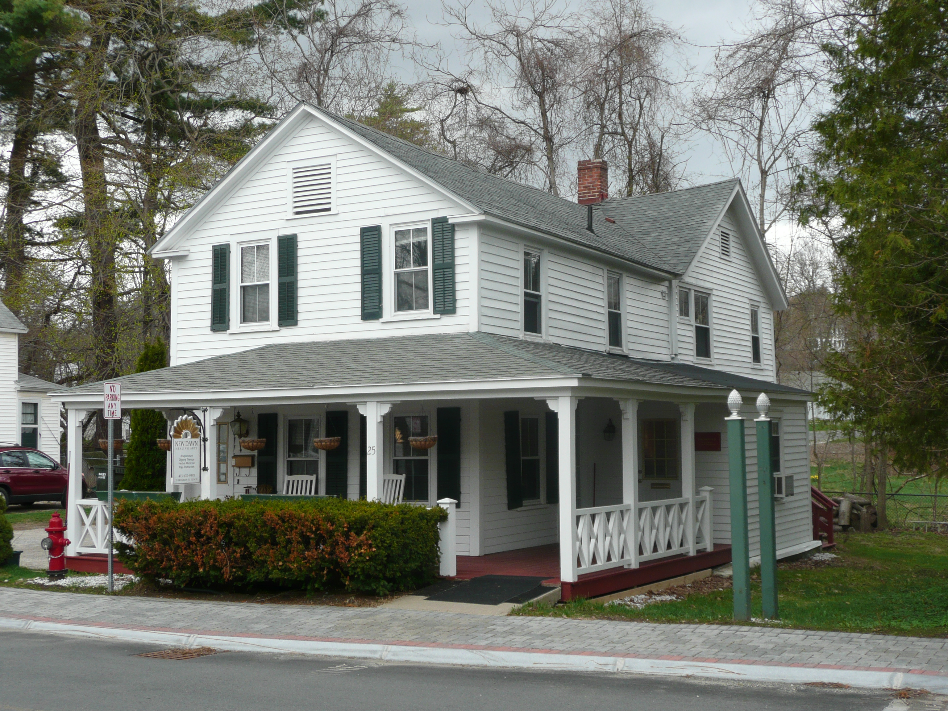
This Gothic Revival style building has two stories, an asphalt shingle roof and is intact. It is a 3-bay, wood frame with a front gable roof, brick interior chimney and wood clapboard siding. The front porch wraps to the right side and the building has 2-over-2 windows.
A modest gable-front house, similar to those built in Lenox throughout the second half of the 19th century. The wrap-around porch is a characteristic method of expanding this type of house, and was probably added after the building’s completion.
HISTORICAL NARRATIVE:
“M. Sadler” on 1854 Clark Map. “K. Crocket” on 1876 Beers Map with rectangular footprint. The present footprint is depicted on the 1893, 1898 & 1905 Sanborn Maps.
This house was built on one of the lots sold by Henry Cook in the 1840’s, when he subdivided his meadowland. Freeman Gates purchased the property in 1848, and built this house shortly thereafter. The house subsequently passed to his son, William Freeman Gates, who in 1872 was declared insane by the court and was no longer allowed to hold property. Daniel Kendall, appointed his guardian, was empowered to sell “all interests of Gates (it being a bare legal title therein the same real estate having been purchased by Martin Sadler in the lifetime of Freeman Gates and paid for but not deeded by reason of some neglect or oversight)”. Perhaps because of the dubious nature of Gate’s ownership, the highest bid on the property was one dollar, submitted by Lorenzo D. Crockett and his son Keziah. The Crocketts ran the stagecoach service from Pittsfield to Lenox, and retained ownership of the house until 1896, when they sold it to Matthew J. Colbert, keeping part of the lot as a site for a new house (21 Franklin St.).
The property was purchased by Mary V. McDermott on November 28, 1989.
BIBLIOGRAPHY and/or REFERENCES:
1854 Clark Map, 1876 Beers Map, 1893, 1898 and 1905 Sanborn Maps
Registry of Deeds, Pittsfield, MA 128.135, 217.1, 298.129
Gazetteer of Berkshire County, 1885
Lenox assessor’s database 2012
