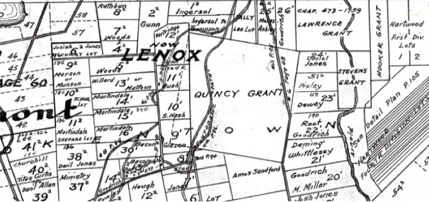
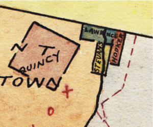
Much of the area north of the village of Lenox was part of the Quincy Grant. Well before Lenox became a town (1767) the royal governor granted land in return for favors or service. One such grant, the Quincy Grant, occupied much of the area between what is now Lenox from Route 7 and 20 past East Street.
In 1737 Edmund Quincy was appointed to a commission to resolve the Massachusetts border with New Hampshire. As part of that commission he traveled to London where he contract smallpox and died. In return for his service his family was, in 1739, awarded 1,000 acres in what would become Lenox.
Other smaller grants in the northern part of Lenox:
• The Stevens Grant – 250 acres in 1756 for the support of the widow and children of Capt. Phineas Stevens. Capt. Stevens had, with 30 militia men, held off put to 700 French and Indians during King George’s War, at Fort Number 4 – the northernmost British outpost on the Connecticut River in modern day Charleston, NH, on the border with modern day Vermont.
• The Lawrence Grant – 353 acres granted in 1758 to compensate for land given to New Hampshire when the new border was drawn.
The fourth grant shown on the map below, the Hooker Grant, was a different situation. It wasn’t made until 1801 and seems to have been an adjustment of boundaries from Washington township.
As with the rest of Lenox proprietors (think of them as investors) picked up the remainder of the land. The map below shows the initial distribution to proprietors and grant holders in the northern part of Lenox. Many of these proprietors and grant holders would fairly quickly sell land to people who would actually do the hard work of cutting down trees, building homes and cultivating the land.
Some of the proprietors shown above would settle on the land they invested in and become major Lenox families including Dewey’s, Roots and Millers. There are dozens of Dewey’s buried in the Church on the Hill Cemetery and the family remained a major presence in New Lenox well into the 20th century.

